CASE STUDY - Developing a Digital Flood Evacuation Model for Climate Change and Wellbeing
Published: 1 April 2019
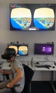
This project developed a 3D virtual reality model to simulate the flooding of an urban space in real time. Showing how a built-up area is likely to flood can help emergency services, local governments and community leaders to consider how a flood might unfold in their local area, helping them to be better prepared for future contingencies in the event of extreme weather.
Case Study
Developing a digital flood evacuation model for climate change and wellbeing
Dr Leslie Mabon and Dr Yang Jiang, SAMS / RGU
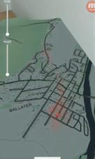
This project developed a 3D virtual reality model to simulate the flooding of an urban space in real time. Showing how a built-up area is likely to flood can help emergency services, local governments and community leaders to consider how a flood might unfold in their local area, helping them to be better prepared for future contingencies in the event of extreme weather. The project took as its basis the town of Ballater, and used available data to construct a 3D virtual reality model of the effects of Storm Frank over 2015-16 on the town. Findings from social science research carried out at the start of the project were used to feed stakeholders’ information requirements—and lessons learned from the 2015-16 events—into the development of the model, and a feedback session was held in Ballater to shape the direction for future collaboration.
|
Background/Context |
|
In late 2018, Dr Leslie Mabon and Dr Yang Jiang were granted funding from the National Centre for Resilience to develop a pilot-scale digital flood model, intended to support community preparedness for future emergencies. Ballater was taken as a case study. |
|
The project was an interdisciplinary venture, linking expertise in qualitative social science (Mabon) and digital environments (Jiang) to develop tools responsive to community requirements and interests. |
Social science research
A crucial first step was understanding the governance and policy framework for flooding and climate resilience in Scotland, and also getting a sense of how people in communities who had been affected by flooding felt about the available data and what might have helped them to be better prepared. To support Dr Mabon’s work, two honours projects were undertaken in the School of Applied Social Studies at RGU focused on flooding in the River Dee. One was an interview-based study conducted with the community in Ballater, led by Alice McBain; and another was an observation and interview-based study into citizen engagement for flood preparedness led by Samantha Kelly.
Development of the VR model
The social science research produced several insights which were important to feed into the development of the virtual reality and augmented reality models. These included (a) the need for more accurate early warning information drawing on available environmental data; (b) the dangers of over-reliance on data and internet connections in an emergency situation; and (c) the value of digital tools for learning and preparedness longer-term post-disaster.
Accordingly, available environmental data for Storm Frank was fed into topographical models of Ballater to create two outputs. One is a 3D virtual reality environment showing the 2015-16 floods. The second is a mobile-based augmented reality visualisation of Ballater. These activities were undertaken within the School of Computing Science and Digital Media at RGU, under the direction of Dr Yang Jiang.

Feedback session in Ballater
At the conclusion of the project, the project team met with representatives of the citizen-led Ballater Flood Group to present outcomes and discuss ways in which the project team could continue to work with the Ballater community beyond the end of the NCR-supported activity. Further work on use of environmental data for early warning systems, and on modelling the effectiveness of different mitigation strategies, were identified as areas where the project outputs could be developed and refined.

International collaboration and learning
To understand how the Scottish flood modelling and engagement community could develop more robust and beneficial outcomes, the project also developed links with Prof Jingming Hou of Xi’an University of Technology in China, including bilateral exchange visits.
|
Three Key Points/Implications/Next Steps from Research |
|
Whilst Scotland has strong and improving climate adaptation policy, there remains a need to support citizen learning and preparedness for flood events. Virtual– and augmented reality tools offer a means of engaging with community members on flood preparedness, response, and learning from previous events. |
|
Developing virtual reality and augmented reality tools requires a breadth of expertises and is inevitably context-specific. Pilot-scale work in Ballater, for example, required social science, environmental science, computer modelling, and computer graphics working together for 12 months. As such, further projects ought to pay cognisance to the staffing and resourcing requirements needed to develop work of this nature. |
|
The involvement of undergraduate students from RGU in data collection for the social science phases of the project also illustrates the potential of university research programmes to act as focal points for community engagement on resilience—especially when integrated into teaching programmes. |
First published: 1 April 2019

